‘Cellar homes’ dot woods of area towns
LYNDEBOROUGH – Like all the older towns in the area, Lyndeborough’s woods are dotted with cellar holes. The “Old Cellar Holes and Building Sites” chapter in the 1905 town history lists about 90 of them.
Lyndeborough’s population reached a peak around 1820 with a population recorded as 1163. The westward migrations began in the 1830s, followed by the loss of people in the Civil War. Farmers had discovered the much better soils – and no rocks – in the mid-west. Many farms were abandoned leaving nothing but the cellar hole and sometimes a foundation.
By 1900, the population was down to 686, and by 1940 about 500. It has now slightly exceeded that earlier high point.
About ten years ago, the Heritage Commission began creating a map showing the locations of those cellar holes, using information previously collected by longtime resident Helen vanHam. Commission members consulted several older residents to add sites to her list.
The original intent of the mapping was to assist the Planning Board when they were creating subdivisions, and to inform logging companies of the holes’ existence, in order to protect them. Some have been damaged and destroyed.
Property owners can, of course, fill them in, as frequently happens when a new house is constructed.
The Heritage Commission added the locations of old stone culverts (mostly on Class 6 roads), abandoned wells, forgotten roads, and other man-made structures. The Commission’s directive is to “protect and preserve man-made structures.” It is an advisory group that complements the Conservation Commission which covers natural areas.
COVID stopped the map-making process, but the unfinished map was recently located and has been digitized. Adding GPS coordinates is under discussion.
The map will eventually be available to the public.
Because these cellar holes are on private land, bottle hunters and those with metal detectors, are reminded that permission must be obtained to visit them.
Cabinet News

Greater Nashua Chamber names Shankey as new CEO

Local students achieve academic honors at Lasell
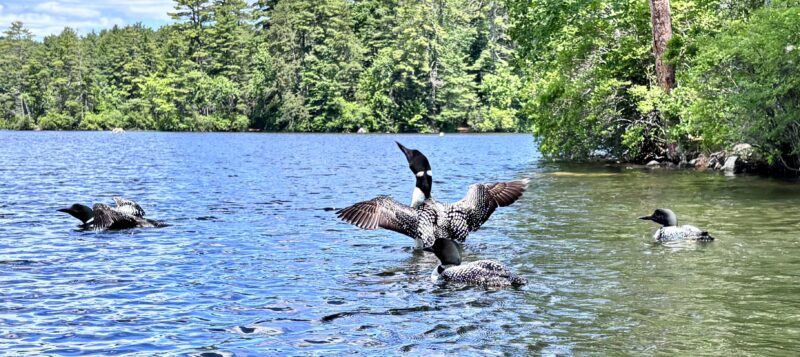
Loons on the lake
Local students achieve academic honors at Champlain College
Local students achieve academic honors at Worcester State