Giant Traveling Map: Facts well stated
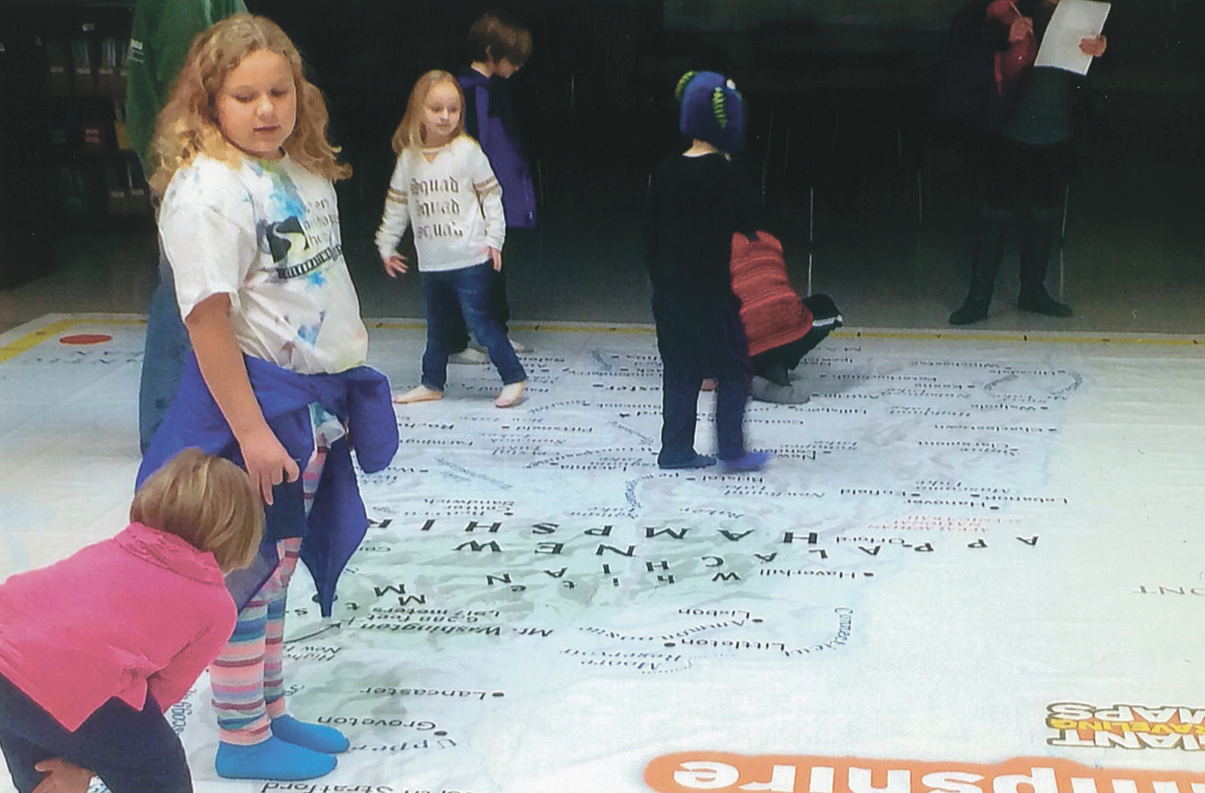
Courtesy photo A district-wide geography night for fourth-graders and their families, recently hosted at Thorntons Ferry School, featured the NH Giant Map, an intriguing tool that helped students learn the computation of distance between two places by using map scale, learning to make turns of 90 degrees and other maneuvers including the computation of latitude and longitude.
Students recently helped each other learn geography at Mastricola Elementary School. They scampered from town to town upon a giant map of New Hampshire that also revealed rivers and lakes and mountains.
Michelle Romein, principal at MES, smiled as the youngsters removed their shoes before walking upon the map of 17 feet by 21 feet. Alice Donahoe, fourth-grade teacher, and Annie Boghigian, kindergarten teacher, directed two weeks of sessions.
Kindergartner Shayla Carmody took a stand upon Manchester. William Saari claimed Londonderry. Classmate James Goodridge commandeered a perch mid-stream in the Merrimack River during a lesson on Feb. 4.
Fourth-grade students sometimes mentored younger kids. The tutors included Matteo Vestri, age 9, who deemed the program “really cool” and Ariana Costa, 10, who said seeing the towns printed “so big” made it easy to comprehend the state’s geography. Ariana Costa, 10, said they all “learned a lot” from the experience.
Donahoe, now in her third year of teaching fourth grade at MES, said kindergarten through grade-four students participated in the map project. She said her desire was to find a novel way to teach methods for illustrating distance scales, learning about longitude and latitude and locating cities by exploring the cardinal directions of north, south, east and west.
“I asked teachers at other district schools how to tie these concepts together in an engaging and memorable way,” Donahoe said. “Soon, I was steered to the idea of utilizing a giant map of New Hampshire.”
The nonprofit New Hampshire Geographic Alliance, supported over three decades by the National Geographic Society Education Foundation and Keene State College, sponsors the Giant Traveling Map program (nhga.net). It launched with help from 20 elementary and middle school teachers.
Donahoe joined the NHGA and received training in how best to use the map, loaned to the school for two weeks.
“During those weeks, students were not only learners but educators,” Donahoe added. “It was a great opportunity for the classes.”
Bohigian, a second-year teacher at MES, pursued the map project with 16 kindergartners who interacted well with their fourth-grade elders.
“We look at maps in the classroom but we do not have one of such a grand scale,” Boghigian said. “This was a map the children could walk on.”
The students’ affinity for geography was credited in part to a previous district-wide geography night presented at Thorntons Ferry School in December with the help of the school’s fourth-grade teachers and others from Reeds Ferry School.
A computer lab was set up there with Google Earth software to show the view from the sky eyes of overhead satellites. Photo displays of New Hampshire attractions were featured. Games and puzzles with New Hampshire themes were shared with students and families.
“It is always great to expose my students to new learning opportunities,” Bohigian said. “They enjoyed learning from the older students something fun and new.”
Romein added that the Giant traveling Map project from the NHGA was one that offered a unique hands-on learning experience for all students.
“Students love teaching and learning from each other,” said Romein. “This is a great example of the many ways teachers make learning memorable for students.”
Loretta Jackson may be contacted via email:
ljackson@nashuatelegraph.com
Merrimack News

Merrimack Police chase down two suspects
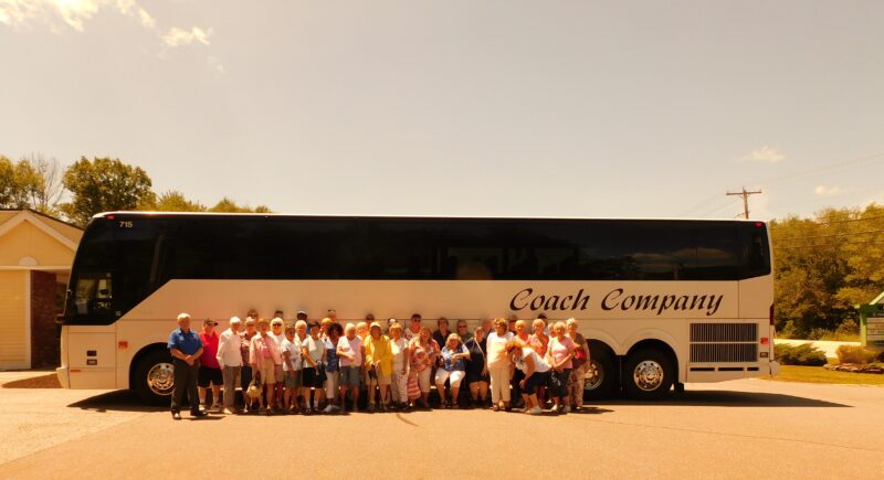
Merrimack Senior Citizen Club gives new meaning to traditional senior trips

Yankee Brass Band concert to crown festivities at Merrimack Historical Society celebration

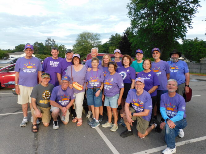
NH Hot Dogz for ALZ nets more than $21k for Alzheimer’s Association
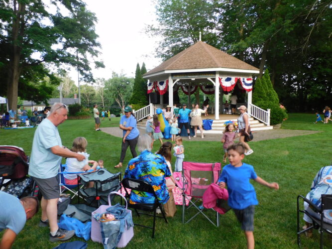
Thursday Night Live summer concert series 2026 returns to Abbie Griffin Park